Ningde Global GeoPark
( chinadaily.com.cn )
Updated: 2011-04-06
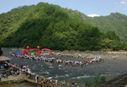
Ningde Global GeoPark is located in Ningde in the northeast of Fujian province in China’s Taimu and Jiufeng mountain ranges. It consists of three scenic areas: Baishuiyang in Pingnan County, Baiyun Mountain in Fuan City and Taimu Mountain in Fuding City. The park is characterized by splendid miarolite mountainous land formations, gorgeous volcanic land formations and a riverbed that leads to waterfalls, deep pools and other costal and island attractions. Various landforms create a rich, colorful and unique combination of settings. The high value of the geology and geomorphology of the park has made it a setting for scientific research and teaching, as well as a destination for sightseeing, relaxation and vacations.
The United Nations Educational, Scientific and Cultural Organization, better known as UNESCO, held a meeting on world geoparks at the Greek island of Lesvos on Oct 3, 2010. At the meeting, Ningde GeoPark was listed in UNESCO's Global Geopark Network (GGN) and received the international designation of “Ningde Global GeoPark”.
Geography
The geographic coordinates of Ningde Global GeoPark are: E119°01′04″~120°23′46″, N26°55′02″~27°13′18″. The park, which covers a total area of 401.34 square kilometers, consists of three scenic areas: Baishuiyang, Baiyun Mountain and Taimu Mountain. The park spans Pingnan County, Fuan City, Fuding City and Xiapu County in northeastern Fujian Province. The park begins at Longyang Village, Xiaoyang Town, Fuan City, in the south, and borders Yuanyang Lake in Shuangxi Town, Pingnan County in the west. The park stretches to Qingyutou, Fuding City, in the south and connects Dayuandang Village, Fuding City, in the east.


