|


Geological Location
( chinadaily.com.cn )
Updated: 2020-03-18
|
|||||||||
 |
|
[Photo provided to chinadaily.com.cn] |
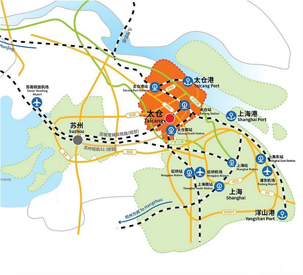
Taicang is located in the southeastern part of Jiangsu province along the south bank of the Yangtze River estuary. It stretches 31 degrees 20 minutes – 31 degrees 45 minutes north latitude and 120 degrees 58 minutes – 121 degrees 20 minutes east longitude. It sits adjacent to the Yangtze River in the east and faces Chongming Island across the river. It borders Baoshan and Jiading districts of Shanghai in the south, Kunshan city in the west, and Changshu city in the north.
Taicang is located in the alluvial plain of the Yangtze River Delta. Its land is flat and inclines slightly from the northeast to the southwest. The eastern part consists of a plain along the river, while the western part is made up of low-lying land. The city belongs to a north sub-tropical humid climate zone with distinct seasons and a moderate climate.
As the nearest port to the estuary of the Yangtze River, Taicang Port has a 38.8 kilometer coastline, of which the deep-water port measures 25 kilometers. The port line is roughly straight and the shoal is stable. It is ice-free and does not silt up throughout the year. The deep-water area is spacious and stable and serves as a turning basin for ships with weights of up to 50,000 tons. It has been named a "golden port" of the lower reaches of the Yangtze River.