



High resolution land cover map developed for environment monitoring









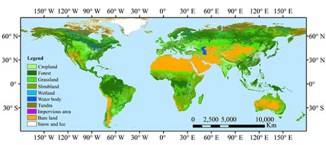
BEIJING - Researchers have developed a 10-meter resolution global land cover map.
To achieve the sustainable development goals with the impact of population growth, urbanization, agricultural expansion, climate change, energy shortage, resource over-exploration, and biodiversity loss, higher resolution land cover information is urgently needed.
The new land cover map FROM-GLC10, with a spatial resolution of 10 meters, can be used in environment monitoring by distinguishing cropland, bodies of water, and forests.
The researchers from the Department of Earth System Science at Tsinghua University, together with domestic and international institutes, collected approximately 480,000 multi-seasonal samples using the Landsat-8 images acquired in 2014 and 2015.
Preliminary results indicated that the overall accuracy of classification could be better than 72 percent.
The map has started providing data services for global users.


- Taiwan experts explore opportunities for win-win AI cooperation
- Shanxi mine safety officials under investigation following deadly coal mine explosion
- Inner Mongolia cheese industry event highlights innovation, collaboration
- Suspect in killing of Chinese citizens repatriated from US
- China targets food safety in face of summer heat, flooding
- Young people and AI discussed in Shanghai





