


Chinese expedition measures thickness of snow at Mount Qomolangma summit


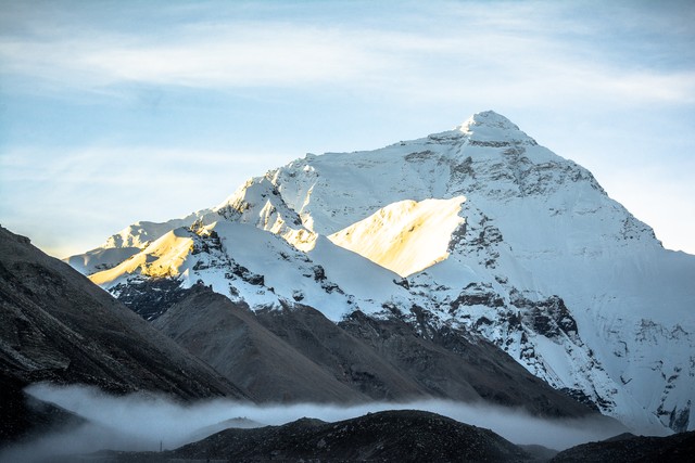
BEIJING -- A Chinese expedition team measured the thickness of snow on Mount Qomolangma with a precise ground-penetrating radar, and the mean depth estimates at the summit are 9.5±1.2 meters, according to a newly-published paper in the journal The Cryosphere.
The data was obtained in May last year during a Mount Qomolangma expedition which formed part of the country's second comprehensive scientific expedition on the Qinghai-Tibet Plateau. Exploring the snow depth on Mount Qomolangma is among the tasks of this scientific endeavor.
By adopting radar profile measurement methods, the expedition team used the 1000 MHz thickness-measuring radar to measure along the exposed bedrock at the top of Mount Qomolangma, and gradually to the summit, said Yang Wei, a researcher from the Institute of Tibetan Plateau Research under the Chinese Academy of Sciences.
He added that the radar measurements displayed a gradual increasing transition of snow depth along the north slope, which made it easy for researchers to interpret the data precisely.
The survey results will provide data support for the study of the dynamic changes of the ultra-high altitude cryosphere and the lithosphere at the top of Mount Qomolangma, and also provide a new direction for a deeper understanding of ultra-high altitude climate changes, said Yao Tandong, team leader of the second scientific expedition.


- WorldSkills Competition to bring more products to people
- Hainan Coast Guard vessel tours stir youth national pride
- Flying Tigers youth delegation visits China-US friendship exhibition
- Senior official Ma Xingrui expelled from CPC, public office
- China allocates supplies, experts to support flood recovery in South China's Guangxi
- China's top political adviser meets representatives of overseas Chinese


