2012-09-18
The coastline is expected to stretch 24.8 km, among the northern coastline 12.85 km and southern coastline 12 km. Total land area would be 25.7 sq km.
2012-09-18
Northern coastline is 12.85 km long, stretching from west to east. It consists of Support System Zone, Petroleum Operation Zone, Operation Zone of Large Dry Bulk Cargos and Crude Oil Terminal Zone.
2012-09-18
Southern coastline would serve as Petrochemical Operation Zone, Support System Zone and Reserved Development Zone.
2012-09-18
The shipping mainline would start from Nangang Road to Nanjiang Bridge. Nangang Road connects Tianjin South Port to Tanggu urban areas.
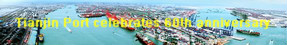
Located at the west coast of Pacific Ocean, west of Bohai bay and Haihe estuary, Tianjin port is on the intersection of Beijing and Tianjin metropolis and economic circle of Bohai rim zone.
Tianjin Port locates at the cross point of Beijing-Tianjin city band and Bohai Rim economic circle. It is the sea gate of Beijing, the important international trade port in northern China and the link to connect Northeast Asia and Central and West Asia.