

Pingnan county
( chinadaily.com.cn )
Updated: 2011-04-01
Pingnan county, located in northeastern Fujian province, enjoys a long history, beautiful landscape, rich cultural heritage, fertile land and abundant resources. After the founding of the People’s Republic of China, Pingnan county became the world-famous “hometown of mandarin ducks”, and the nationally known “home of summer mushrooms” and “home of Younai plums”. The county is also known as China’s “home of hydropower”.
Pingnan is an inland mountainous county. It links Ningde City to the southeast, borders on Zhouning County to the northeast, connects Zhenghe County to the north, and is adjacent to Jian’ou County to the northwest. Pingnan meets Gutian county to the southwest. The county is about 1470.67 square kilometers in size.
Historical relics and archaeological data indicate that people have lived on this land for at least 3,000 years. Pingnan used to belong to Gutian county. It became a county in the 13th year of Emperor Yongzheng’s reign in the Qing Dynasty. Since it is located south of Cui Ping Mountain, Emperor Yongzheng named it “Ping Nan”.
In 1996, the county administered four towns, seven townships, 153 administrative villages and five neighborhood committees. The county has 38,424 households and 183,900 people. The county is home to 10 ethnic groups which account for 0.4 percent of the population. The She people make up the largest ethnic group. Other ethnic groups include Hui, Tibetan, Mongolian, Korean and Zhuang.
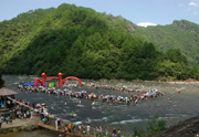
Pingnan county has beautiful natural landscape and abundant resources. It is in the middle section of the Jiufeng Mountain Range. Most of the land is 800 meters above sea level. There are more than 300 peaks, and 265 of them are 1,000 meters above sea level. Dongfeng Peak in Lingxia Township is 1,627 meters above sea level. It is the highest peak in the county. The lowest area is Yuanping Village in Shoushan Township, which is only 250 meters above the sea level. The county belongs to the zone of middle mountains, low mountains, highlands, basins and valleys. Mountains account for 81 percent of the total area, while farmland comprises only 9.1 percent of the total area. Forests cover 81.21 percent of the total area, giving the county 86.9 percent green coverage and 3.03 million cubic meters of available timber.
The county has 186 streams, which form two major water systems: Huotong Creek and Gutian Creek. The drainage area is more than 60 square kilometers. There are seven major streams. The annual average runoff is 1.75 billion cubic meters. The streams are narrow and have a large falls and strong currents, creating a powerful resource for hydraulic energy. The theoretical hydraulic energy storage of the county is 197,200 kilowatts, and the energy available for use is 474,000 kilowatts.