


China launches home-grown aeronautic remote-sensing system


BEIJING -- China's new aeronautic system for conducting detailed observations and monitoring of Earth's surface passed its final acceptance stage on Thursday and is now formally in operation.
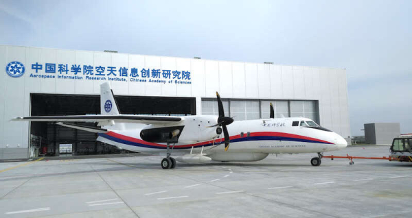
The Chinese Aeronautic Remote Sensing System, which consists of two medium-sized manned aircraft together with a range of remote-sensing technologies, was developed by the Aerospace Information Research Institute of the Chinese Academy of Sciences.
According to Ding Chibiao, vice-president of the institute, aeronautic remote-sensing images are needed to assess road damage, landslides and collapsed houses when people suffer from severe earthquakes or floods. Remote sensing is widely used in disaster prevention and alleviation, agriculture, forestry and fishery, water conservancy, surveying and mapping.
Compared with space-based remote sensing, aeronautic remote sensing offers higher resolution and precision. It can take pictures of the ground continuously, all day long, producing clearer images.
The CARSS also incorporates the functions of real-time processing and satellite communication, contributing emergency-response operations, including disaster prevention and reduction.
During its trial operations, the system conducted major aeronautic scientific experiments, as well as a calibration flight for the new remote-sensing payload, and a disaster and environmental monitoring flight.
In the next phase, the system will be made available to users in various fields.


- China unveils 5-year plan to upgrade supply and marketing cooperatives
- China activates Level IV flood response in Heilongjiang
- China announces new steps to protect Huangyan Island National Nature Reserve
- Inner Mongolia's Hohhot named 'World Dairy Capital'
- Latest medical team leaves China to fight DRC Ebola outbreak
- China reports COVID-19 activity at moderate level


