


Want to measure a mountain? Ask Guangdong


New technologies and equipment developed in Guangdong province have played an important role in measuring the height of Mount Qomolangma.
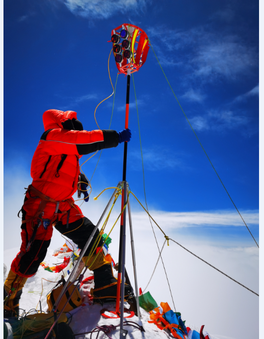
Ice and snow radar detectors, surveyor's beacons and related equipment developed by Guangzhou-based South Surveying and Mapping Technology Co have withstood harsh environmental tests, including low oxygen, extreme cold, low pressure and powerful winds and have helped surveyors successfully complete the task of measuring the height of the world's highest mountain in recent months, authorities said.
It demonstrates the technical strength of China's domestic surveying and mapping instruments and equipment, they said.
The height of Qomolangma has been updated by surveyors. China and Nepal have agreed on an altitude of 8,848.86 meters above sea level. The updated measurement was jointly announced by President Xi Jinping and his Nepalese counterpart, Bidya Devi Bhandari, in an exchange of letters on Tuesday.

"Guangdong has achieved rapid progress in the development of surveying and mapping geographic features in recent years," said Yang Lin'an, deputy director of Guangdong's Department of Natural Resources.
During the 13th Five-Year-Plan period, the total output value of the geographic surveying and mapping industry reached about 50 billion yuan ($7.69 billion), according to the province. The output value of internet integration industries and related sectors exceeded 200 billion yuan.
The geographic information industry in Guangdong currently employs more than 100,000 people.
Mount Qomolangma, also known as Mount Everest in the West.


- China's student aid tops 390b yuan in 2025 as coverage expands
- Former Chongqing political advisor sentenced to life for bribery
- Sinan Mansions records 3.2m annual visitors as cultural initiative enters second decade
- China's AI governance plans hailed amid rising global regulatory challenges
- Shanghai Tonight puzzle adventure reimagines night walks
- Global ocean governance at critical juncture amid rising unilateral actions


