NASA releases high-resolution moon map
Updated: 2011-11-21 15:57
(Agencies)
|
|||||||||||
 |
|
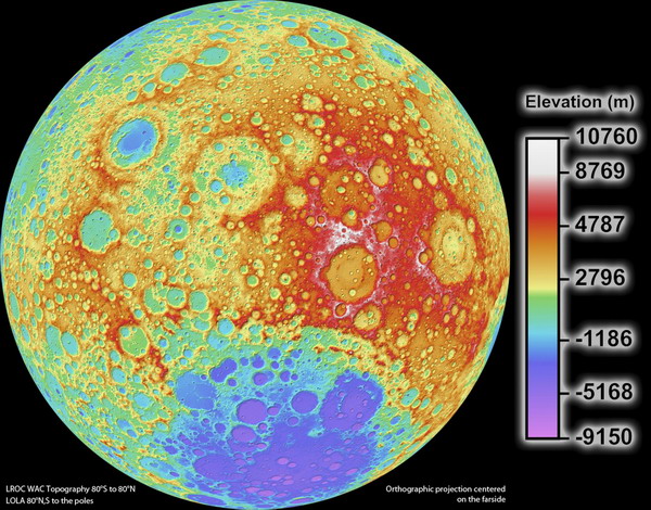
The highest resolution near-global topographic map of the moon ever created is shown in this photograph released on Nov 16, 2011 by the science team that oversees the imaging system on board NASA's Lunar Reconnaissance Orbiter (LRO). The new topographic map shows the surface shape and features over nearly the entire moon with a pixel scale close to 100 meters (328 feet). A single measure of elevation (one pixel) is about the size of two football fields placed side-by-side.[Photo/Agencies] |


Hot Topics
HIV/AIDS, Egypt protest, Thanksgiving, climate change, global economic recovery, home prices, high-speed railways, school bus safety, Libya situation, Weekly photos
Editor's Picks

|

|

|

|

|

|