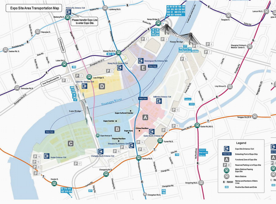
 Expo Site Transportation Map
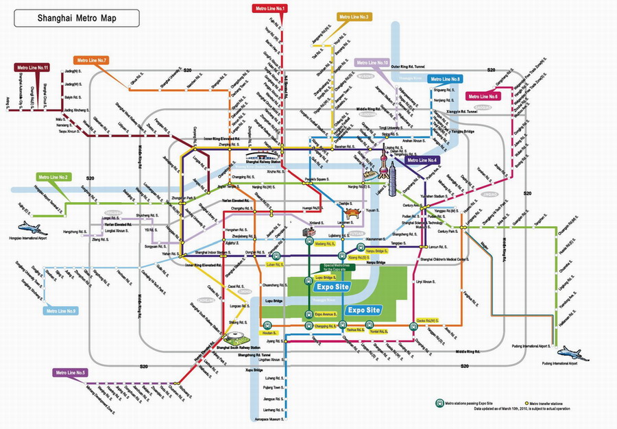
Shanghai Metro Map
For visitors' convenience to the Expo Site, Shanghai is constructing a comprehensive urban transport system and an Expo public transport network which enables visitors to reach the Expo Site via rail transit, bus and water transportation.
There is one metro line entrance/exit, eight ground entrances/exits, four extra-Site and three intra-Site water gates.
Metro Line Entrance/exit
|
Puxi Section |
Madang Road Station of Metro Line 13 |
Ground Entrance/exit
|
Puxi Section |
Entrance/exit at Luban Road, South Xizang Road,
Bansongyuan Road |
|
Pudong Section |
Entrance/exit at Bailianjing, West Gaoke Road, Shangnan
Road, Changqing Road, Houtan |
Water Entrance/exit
|
Extra-Site Water Gate |
Dongchang Road Water Gate, Qichangzhan Water Gate,
Shiliupu Water Gate, Qinhuangdao Road Water Gate |
|
Intra-Site Water Gate |
Dock 1 (Miaojiang Road • Wangda Road)
Dock 2 (Expo Avenue • Bailianjing Road)
Dock 6 (Houtan Garden) |
Intra-Site Transport
On most occasions, visitors can get to pavilions on foot in the Expo Site.
Since the Expo Site is divided by the Huangpu River and there is quite a distance between the zones, the Organizer sets up a public transport system including metro line, bus and cross-river ferry.
|
Metro Line
|
Metro Line 13 is designed to facilitate visitors' travelling between
Pudong and Puxi Sections. There are Madang Road Station,
Lupu Bridge Station, and Expo Avenue Station on the line. |
|
Ground Transport
|
Five bus routes, including two sightseeing routes, are
designed to facilitate visitors' touring in Pudong or Puxi
Section and traveling between the two sections. |
| Water Transport |
Five ferry routes are designed to facilitate visitors’ traveling between
Pudong and Puxi Sections. |