Satellite image of quake-striken Beichuan
(Agencies)
Updated: 2008-05-16 13:58
Updated: 2008-05-16 13:58
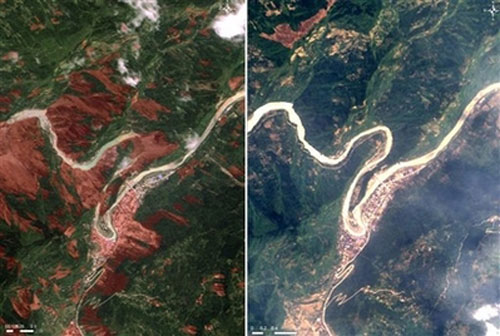
This handout satellite image (L) taken by Taiwan's FORMOSAT-2 on Wednesday, May 14, 2008 and released on May 16, 2008, shows the areas (in brown) devastated by Monday's 7.8-magnitude earthquake in Beichuan County of southwest China's Sichuan province. The photo would compare the same areas in an image taken in 2006 (R). [Agencies]
|
||
|
||
|
|
|
|