CHINA> About Xinjiang

|
CHINA> About Xinjiang
|
|
Brief Intro To Xinjiang Uygur Autonomous Region
(Xinhua)
Updated: 2009-07-08 13:26
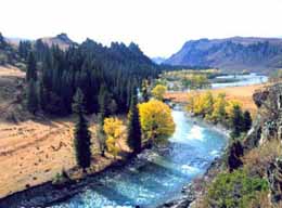
Xinjiang, China's largest province-level unit of administration in terms of territory, stretches along the National Highway 312 from Urumqi and Turpan in the east to Horgas and Yili in the west, with stops in various major cities and same towns along the way, including Changji, Kuiton and Shihezi.
Area: 1,600,000 sq km Climate: While Xinjiang enjoys between 2,500 to 3,000 hours of sunshine each year, the amount of annual precipitation for the entire region averages a mere 150 milliliters (ml), and thus the air is quite dry. Provincial capital: Urumqi Population: 19.33 millions (2003) Xinjiang was home to 47 of China's 56 ethnic groups, including the Uygur (45.62 %), Han(39.87 %) and Kazak (6.99 %) ethnic groups, as well as the Mongolian, Khirghiz, Xibe, Tajik, Uzbek, Manchu, Daur, Tartar and Russian ethnic groups. The predominant languages in use today, however, include Chinese, Uygur, Kazak, Mongolian, Xibe and Kirghiz. |
|||||