A landscape that ignites the imagination


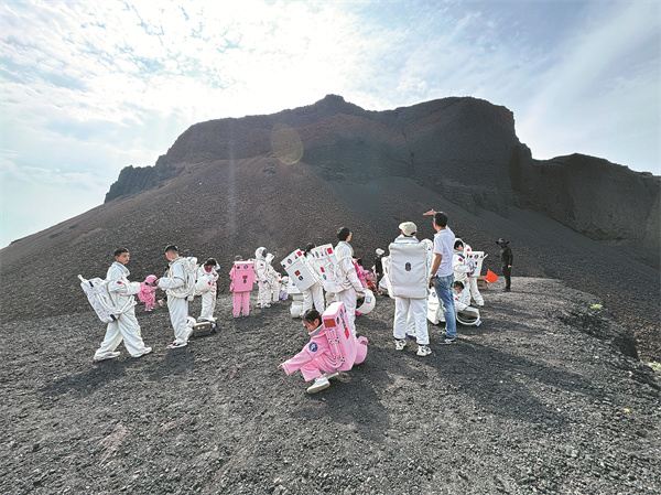
I could see dozens of "astronauts" about to embark on a "spacewalk", whether on the moon or Mars I could not tell, but they were about to go wherever they wished anyway.
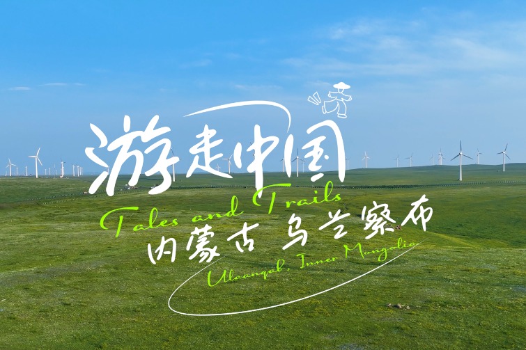
Earlier this month, I visited the Ulanhada volcanic geopark in Ulaanqab, North China's Inner Mongolia autonomous region, and found myself in this otherworldly scene against the backdrop of a volcano with dark rocks.
I wandered through, collecting black volcanic glass pieces with a bluish sheen that caught my eye, while watching them posing for pictures that must have been rewarding enough for a hot summer afternoon.
In Mongolian, Ulanhada means "red rocks". With some 30 volcanoes varying in age, size and shape strung on the grassland — and the convenience of a high-speed train taking only around two hours from Beijing to Ulaanqab — the park has become increasingly popular in recent years. During the five-day May Day holiday alone, it received nearly 200,000 visits, according to staff member Luo Yu.
For a long time, local people have referred to these volcanoes as "alchemy furnaces" or "burning mountains", despite the fact that it wasn't until 2012 that they were investigated and recognized by the academic community.
That afternoon, I climbed up and took a stroll in the crater of the Northern Alchemy Furnace Volcano, where a variety of grass grew tall and swayed in the wind. Outbursts of vitality are often seen around these volcanoes that have been dormant for around 6,000 years.
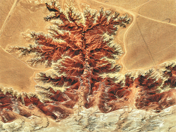
I've seen many aerial photos online that capture the volcanoes from directly above, which looked like a scrutinizing eye staring back at me. In fact, apart from its renowned grasslands, Inner Mongolia boasts diverse geographical landscapes that offer a kaleidoscope of scenery from various alternative viewpoints of observation.
After hours of driving on the highway — during which we once passed through an almost uninhabited area spanning dozens of kilometers, devoid of people, vehicles or houses and with weak cell coverage — we arrived at Dahongshan (Big Red Mountain) in Ulaanqab's Siziwang Banner, a stretching red cliff mesa rising above an expansive sea of grass.
Viewing from high above, the fiery-red Danxia cliffs with rugged rims, sculpted by erosion over millions of years, resemble the earth's blood vessels. Standing at the edge of the cliffs, where the wind howled in my ears and almost knocked me down, various shades of red from the cliffs came into view, and I came to appreciate the dwarfed yet tenacious shrubs on that desolate tableland.
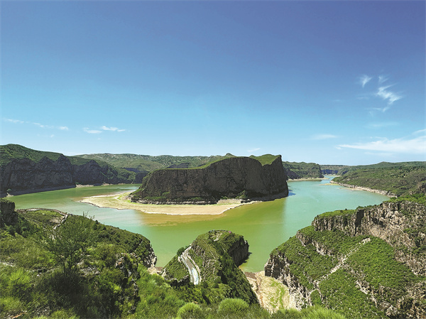
Down south, in Qingshuihe county of Hohhot, the Yellow River winds through, making oxbow turns and separating Inner Mongolia from Shanxi province at Laoniu Bend. Looking across the clear river from the Laoniu Bend Fort, ruins of a section of the Ming Dynasty (1368-1644) Great Wall can be seen, along with a beacon tower standing guard on a sheer cliff, the contour of which resembles the shape of an ox lying on its belly.
As we sailed on a speedboat toward Taiji Bend, I looked up at the cliffs and noticed traces of erosion — the determined carvings and water streaks the river has imprinted on the precipice — interspersed with the greenery growing out of the rock crevices, which reminds me of spontaneous ink-wash landscape painting.
Tour guide Zhang Zhen told me they call the cliff walls Qianli Jiangshan Tu (A Panorama of Rivers and Mountains), borrowing a name from the 900-year-old blue-green landscape painting masterpiece by Song Dynasty (960-1279) painter Wang Ximeng.
Observing the texture of the cliffs from below and joining in a game guessing the nicknames of the rocks perched on the top was a fun experience to admire nature's mighty creativity.
At Taiji Bend, the Yellow River executes a curvature of nearly 270 degrees, the sharpest turn along its middle reaches, Zhang says. From the sightseeing platform, the shifting colors of the water were clearly visible, with the transition like the gradual diffusion of ink.
Following a winding graffiti road down to a spit of land they call Ruyi Peninsula, we lingered for a while, escaping from our lifeworld. Where the river's rhythmic beats against the cliff face could be heard, my weariness eased, and my mind was soothed.
Yuan Hui contributed to this story.