Challenging expedition results in a mountain of data


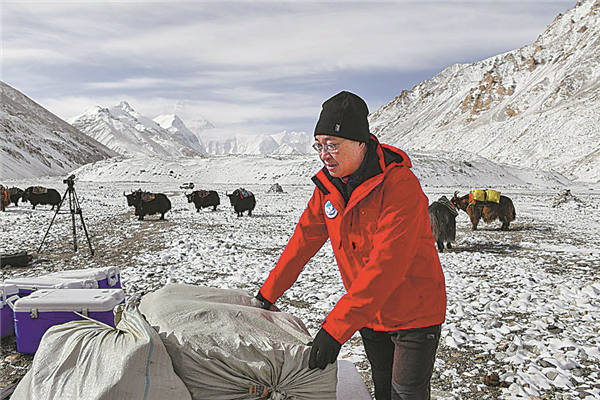
The tan line on Kang Shichang's face is a reminiscence of the eight days and seven nights he spent doing glacier research work on Mount Qomolangma, the world's highest peak, and he deems it his greatest medal.
"Sunscreen obviously did not work so well since I trekked for eight to nine hours a day in the sun," says Kang, a researcher from the Northwest Institute of Eco-Environment and Resources, Chinese Academy of Sciences.
Kang is the leader of the glacier and pollutant research squad, part of the scientific research team in the comprehensive scientific expedition on Mount Qomolangma, also known as Mount Everest in the West.
From May 1 to 8, the 18-member squad scanned a record area of 22 square kilometers at the East, Middle and West Rongbuk glaciers at altitudes between 5,200 meters and 6,500 meters using a drone and a high precision 3D laser scanner. They also measured the thickness of ice and snow and collected some samples at the East Rongbuk Glacier.
Wang Shaoyong, a squad member and a doctor from the institute, says the highly-intensive work was physically challenging.
Wang and his teammates took turns dragging the ground-penetrating radar to measure the glacier ice thickness, following a zigzag trajectory on the surface of East Rongbuk Glacier.
"It felt like my heart was going to pop out," says Wang, 29, adding that his heartbeat reached as high as 160 beats per minute.
During the period, the squad spent a night in a tent erected at an altitude of 6,350 meters.