Oceanographic research satellite launched


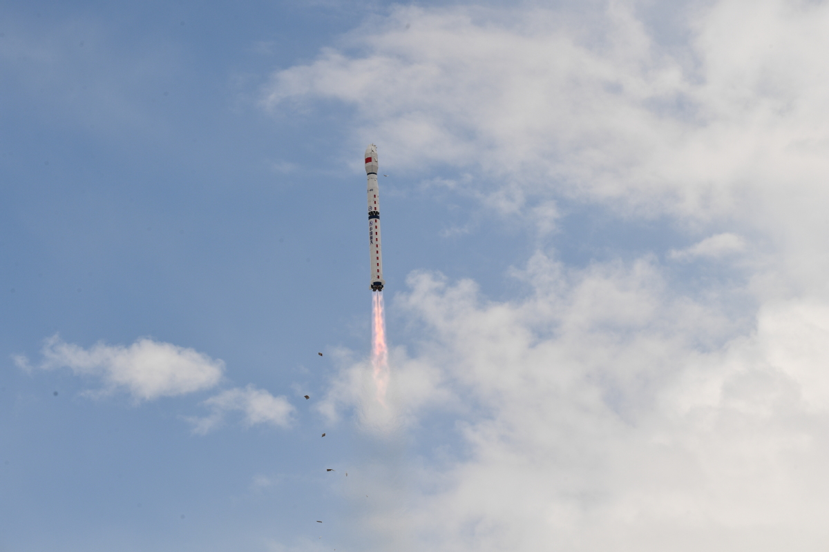
China launched its latest oceanographic research satellite, HY-2D, on a Long March 4B carrier rocket from the Jiuquan Satellite Launch Center in the Gobi Desert on Wednesday morning, the China National Space Administration said.
It said in a statement that the satellite will be tasked with working with its two predecessors-HY-2B and HY-2C-to form a space-based network monitoring the marine environment around the clock.
HY-2B was lifted into orbit in October 2018 atop a Long March 4B launched from the Taiyuan Satellite Launch Center in Shanxi province. HY-2C was launched in September last year by the same type of rocket from the Jiuquan center.
Data generated by the network, which is operated by the Ministry of Natural Resources, will be used in marine weather forecasting, early storm warnings, maritime transportation, and oceanographic and climate change research, the administration said.
The network is expected to enable China to scan more than 80 percent of the world's oceans in a matter of hours, strongly improving its marine observation efficiency and accuracy, said Zhang Qingjun, chief designer of the HY-2 series satellites at the China Academy of Space Technology in Beijing.
He said that HY-2 satellites have helped the country forecast and monitor typhoons in coastal regions in a timely, accurate manner, contributing a lot to disaster prevention and relief work.
Fishermen in China have also benefited from data obtained by the space-based system, Zhang said, citing statistics from several fishing companies.
"The network helps them to save about 5 percent of fuel consumed by each fishing ship and also increases the average harvest by 2 to 3 percent," Zhang said.
In addition, the network is able to closely track and monitor ships' locations, routes and speeds, providing important information for their navigation and positioning, and search and rescue efforts.
China started discussing the construction of marine research satellites in the 1980s, according to the China Academy of Space Technology.
It launched its first marine observation satellite, HY-1A, in May 2002, laying the foundation for an oceanographic monitoring system.


- Wedding platform in china offers hefty salary for 'wedding surrogate' role
- Co-location boosts rural vitalization in Shandong
- New draft law requires improvement of energy development
- Chongqing Library expert educates students in book restoration techniques
- Xi Jinping on his love of books
- Experts hail China's progress in immunization