Severe convective weather to persist


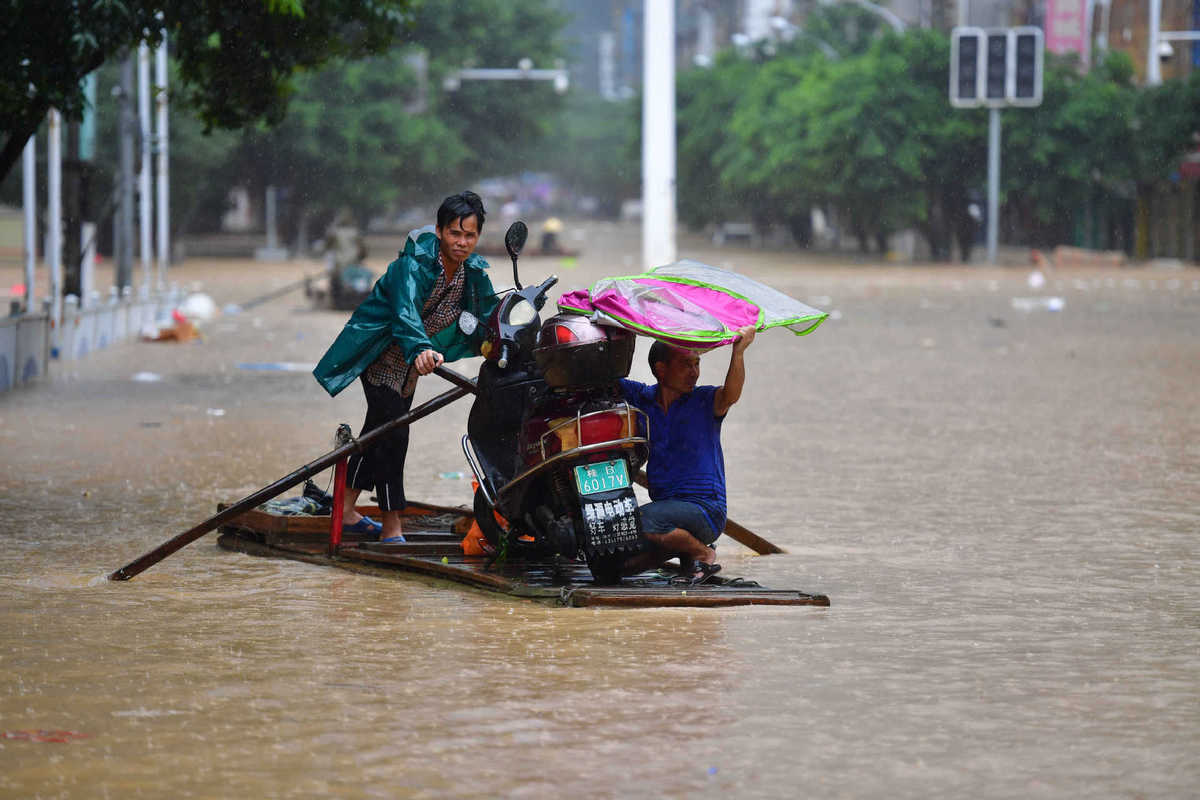
The country has been frequented by severe convective weather, a phenomenon often accompanied by locally heavy rainfall, so far this rainy season, and its frequency is expected to remain high until August, according to the National Meteorological Center.
Per the center, since June, the country has been hit by 16 regional severe convective weather processes, and seven of them happened in northern parts of the country.
Severe convective weather refers to sudden and very destructive weather phenomenon that often includes thunderstorms, hail, gales and locally heavy rain. Small in size and sometimes only spanning 10 kilometers, such events can produce intense precipitation.
According to the center, when a severe convective weather event occurred on July 3 in Beijing, for example, the Hongta monitoring station in Changping district recorded daily precipitation of 145 millimeters, about one-third of the annual precipitation in the capital.
In a rainfall event under the influence of severe convective weather on July 6, the highest hourly precipitation recorded by the Dahongmen monitoring station in Beijing's Fengtai district on the day reached 89 millimeters.
"Compared with the past three years, the frequency of severe convective weather was generally in a rising trend in the first half of this year," said Lan Yu, deputy head of the national center for severe convective weather prediction at the center, in an interview with China Daily.
A total of 22 severe weather events occurred during the first six months of the year, a five-year high for the period, he added.
Lan warned that the frequency of such destructive weather will grow as midsummer arrives.
"According to climate statistics, the period from July to August has the highest frequency of severe convective weather. The likelihood is great that there will be even more frequent spells of brief but heavy precipitation, thunderstorms, gales and hail in the coming two months," he noted.
On Wednesday morning, the center issued a blue alert for torrential rains in nine provincial regions, including the eastern parts of Sichuan province and Shanghai, warning that hourly precipitation in some of the regions could be up to 60 millimeters in the 24 hours starting 2 pm that day. It also said rainfall will be accompanied by thunderstorms and gales.
The weather phenomenon can cause severe damage. For example, gales can be powerful enough to make aircraft crash during takeoff or landing. Also, brief but heavy rainfall could result in flooding in urban areas.
Southwest monsoons and cold fronts in the northern parts of the country are similar in strength in May and July. The seesaw battle between them is a major cause of the occurrences of severe convective weather events in the middle and lower reaches of the Yangtze River, Lan explained.
He said that despite great improvements in the country's ability to predict such weather events, forecasts remain a hard nut to crack for atmospheric scientists all over the world.
Generally, the country now has the capability to forecast regional severe convective weather events one to three days in advance. For those sudden medium and small-sized events, it is capable of carrying out real-time monitoring and issuing early warnings in a timely manner, he said.


- Mainland says PLA drills warn Taiwan independence forces, foreign backers
- British writer donates family's archives to Peking Union Medical College Hospital
- Taiwan separatist forces are heading for a 'dead end', expert says
- A suspect involved in kidnapping and murdering Chinese citizens extradited to China
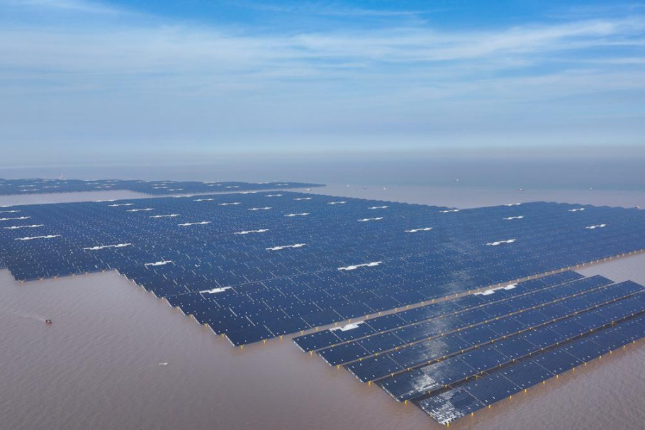
- Shandong connects 1,000 MW offshore solar project to the grid
- Top political advisor meets Chinese Buddhist delegates