Mapping a way to avoid pollution


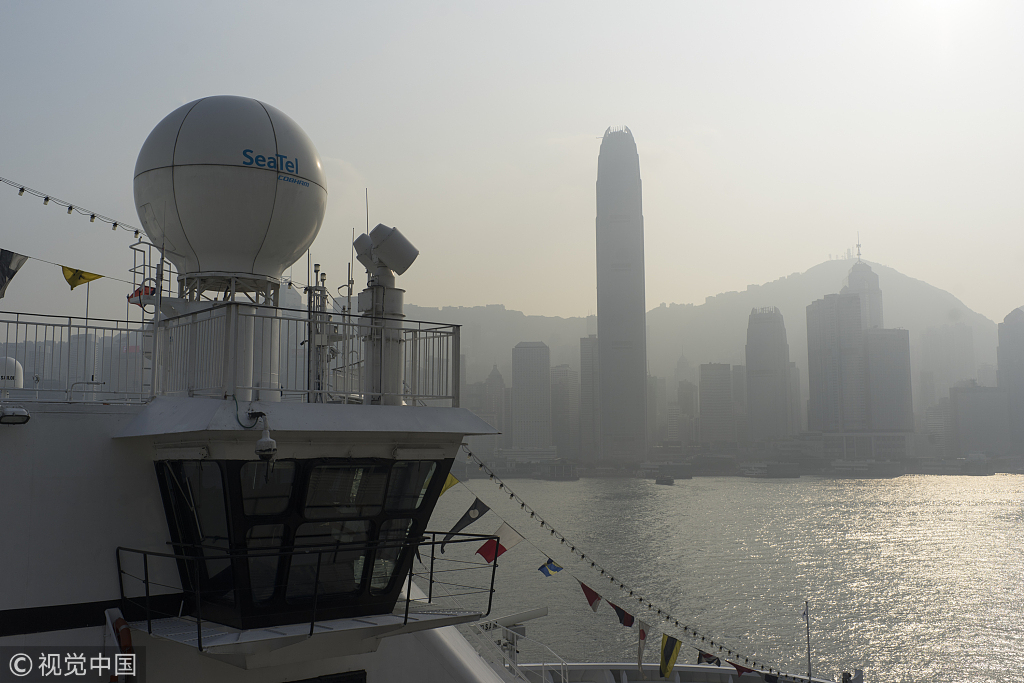
Hong Kong's Environmental Protection Department operates 16 air quality monitoring stations across the city, three of which are beside roads. They provide the public with the government-designed Air Quality Health Index, which converts air pollution concentrations into a scale ranging from one, at the low end, to 10-plus.
Li considers the air quality information provided by the monitoring stations inadequate, arguing that the number of measurements is limited and data is too sparse geographically.
"Air quality is not like temperature, the variation of which is very small within a day," Li said. "You can have one part of the city badly polluted, but just a few blocks away the air quality may be much better."
Li and his team are designing a data-driven air pollution estimation model, based on more than 10 types of data related to urban dynamics, including air pressure, humidity, temperature, wind speed, wind direction, traffic speed and more.
With the application of artificial intelligence, the model is able to transform the measurements from the 16 government monitoring stations into 110,000 virtual stations covering the whole city and bring readings right down to street level.
Their study, published in February in the peer-reviewed journal Environmental Science and Policy, collected data for ambient pollutant concentrations from the city's Environmental Protection Department, vehicular traffic data from the Transport Department, meteorological data from the Hong Kong Observatory, and urban morphology data, including road maps, from Baidu Maps.
Li said the estimated air pollution concentrations achieved an accuracy rate of 82 percent, and that would be improved to over 90 percent when additional data is incorporated into an improved model. The team is currently gathering data on the height and density of Hong Kong's skyscrapers.
Clear relationship
The project evolved from an interdisciplinary study, involving scholars from public health management, environmental policy and environmental management. The University of Cambridge in the United Kingdom also cooperated in the study, joining with the Hong Kong research team to create the HKU-Cambridge University Clean Energy and Environment Research Platform. The Hong Kong government contributed HK$50 million ($6.37 million).
Preliminary research by the Hong Kong team has shown a clear relationship between higher air pollution and social deprivation.
The findings show low-income households are more likely to be located in areas exposed to higher PM2.5 concentrations than high-income households, with relatively impoverished parts of the city, such as Yuen Long, Sham Shui Po and Kwun Tong, generally steeped in higher levels of hazardous PM2.5 than areas on Hong Kong Island.


- Chinese astronauts complete 1st cave training
- Xi meets Taoiseach of Ireland
- Themed high-speed train of Harbin Ice-Snow World starts operation
- Research establishes brain normative references for Chinese population
- Chinese scientists confirm planet identity for free-floating object
- China issues plan of action to improve treatment of solid waste